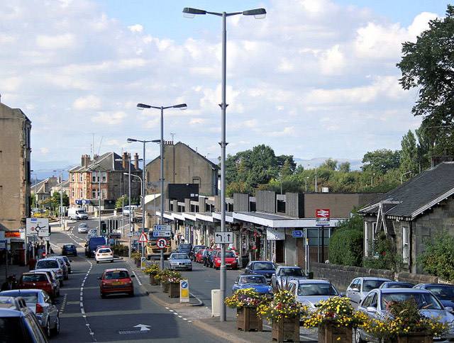
East Renfrewshire · Scotland
Clarkston population
9,460people · latest estimate

Clarkston has a population of 9,460, making it the 4th largest place in East Renfrewshire. In 2005 the World Gazetteer recorded 19,064, a fall of 50.4% since.
The other populations of Clarkston
The same name covers more than one area, and each has its own figure.
| What you mean | Population | Source |
|---|---|---|
| The place itself The populated settlement, roughly the built-up core. |
9,460 | GeoNames |
| The place in 2005 The same settlement twenty years earlier. |
19,064 | World Gazetteer (2005) |
Why these differ: which population figure is right? · compare with another place
Year-by-year official estimates for the wider area: East Renfrewshire population trends, 2001–2024.
Clarkston in context

Distances are straight-line from the settlement's recorded coordinates. The 10 km figure sums the recorded places within that radius, so it describes how built-up the surroundings are rather than people per square kilometre.
The population, measured on a real boundary
| What you mean | Population | Source |
|---|---|---|
| Clarkston locality NRS census geography: the continuously built-up Clarkston | 9,484 | Census 2022 |
| Clarkston (GeoNames record) the figure in this page's heading; boundary unstated | 9,460 | GeoNames |
The locality figure is Scotland's Census 2022, summed over the Scottish Postcode Directory's own postcodes for this locality; across all of Scotland that method lands within 601 people of the national census total. Where the two rows disagree, the census locality is the figure to quote.
Food and drink, from the register
| Category | Count | Per 10,000 |
|---|---|---|
| Takeaways | 17 | 17.9 |
| Restaurants and cafés | 13 | 13.7 |
| Pubs and bars | 2 | 2.1 |
| Supermarkets and convenience | 1 | 1.1 |
Registered food establishments in the Clarkston locality, from the Food Standards Agency register. Scotland runs the Food Hygiene Information Scheme (pass or improvement required) rather than England's 0–5 scores, which changes nothing here: these are counts of premises, not judgments of them.
Age profile
| Measure | Value |
|---|---|
| Median age (exact) | 44 |
| Under 15 | 19.6% |
| 65 and over | 20.0% |
| 85 and over | 2.7% |
Scotland's Census 2022 publishes single year of age at output-area level, so this median is exact — the middle resident's actual age, with nothing interpolated. England's published tables stop at five-year bands, which is why English pages label their medians estimated and this one is not. Percentiles compare the 90 Scottish towns of 10,000+ residents with each other, never with England or Wales: their figures are a different census year, and a percentile that quietly mixed the two would be a lie with a percent sign.
Who owns the homes
| Measure | % of households |
|---|---|
| Owned, outright or with a mortgage | 96.9% |
| of which owned outright | 50.7% |
| Social rented | 0.4% |
| Private rented | 2.5% |
| Household has no car or van | 9.5% |
| Household has two or more | 47.6% |
Scotland's Census 2022, over the 3,558 occupied households of the locality. Shared ownership and shared equity count with mortgaged homes; every share is of households, not residents.
Getting to work
| How working residents travelled (census day) | Share |
|---|---|
| Worked mainly from home | 37.8% |
| Car or van (of those who travelled) | 76.5% |
| Public transport (of those who travelled) | 14.5% |
| On foot (of those who travelled) | 4.9% |
| Bicycle (of those who travelled) | 2.1% |
Scotland's Census 2022, collected 20 March 2022: past the last legal restrictions, but with home working still far above the old normal, so these are census-day records and mode shares are of the 4,397 employed residents who travelled, never of everyone.
Deprivation
The middle postcode here sits in decile 10 of the Scottish Index of Multiple Deprivation, where decile 1 is the most deprived tenth of Scotland's data zones and 10 the least. 0% of the locality's postcodes sit in the most deprived three deciles, 98% in the least deprived three.
SIMD 2020, Scotland's own index — never comparable with England's IMD, and never compared here. Weighted by postcodes rather than people, because the postcode file carries no population, and said so for the same reason the postcode-district pages say it.
Care homes, as Scotland's regulator grades them
Care homes for older people in the locality, by their lowest current grade: 1 very good.
The Care Inspectorate's six-point scale (excellent down to unsatisfactory), shown by each service's minimum current grade because that is the Inspectorate's own headline convention. Scotland's regulator and scale, never translated into the CQC's words.
Railway stations
Stations in the locality: Clarkston (320,542 entries and exits, ORR estimate), Williamwood (286,358 entries and exits, ORR estimate).
Stations are the DfT's NaPTAN register located by coordinates; passenger figures are the Office of Rail and Road's estimates, and a station shown without one did not match the ORR table by name. Bus stops are not shown for Scottish towns: the national stop register's west-of-Scotland submission is incomplete enough that a count would mislead, and no figure beats a wrong one.
Go deeper
Nearby in East Renfrewshire
| # | Place | Population |
|---|---|---|
| 1 | Newton Mearns | 28,210 |
| 2 | Barrhead | 17,890 |
| 3 | Giffnock | 12,070 |
| 4 | Neilston | 5,310 |
| 5 | Netherlee | 4,550 |
| 6 | Thornliebank | 4,190 |